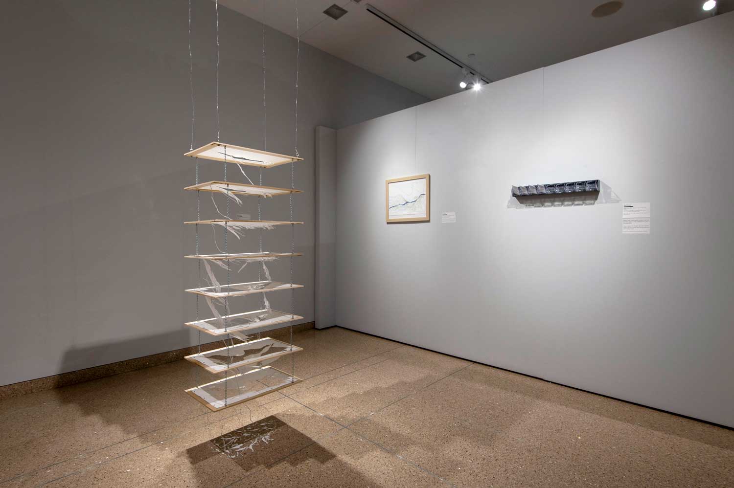
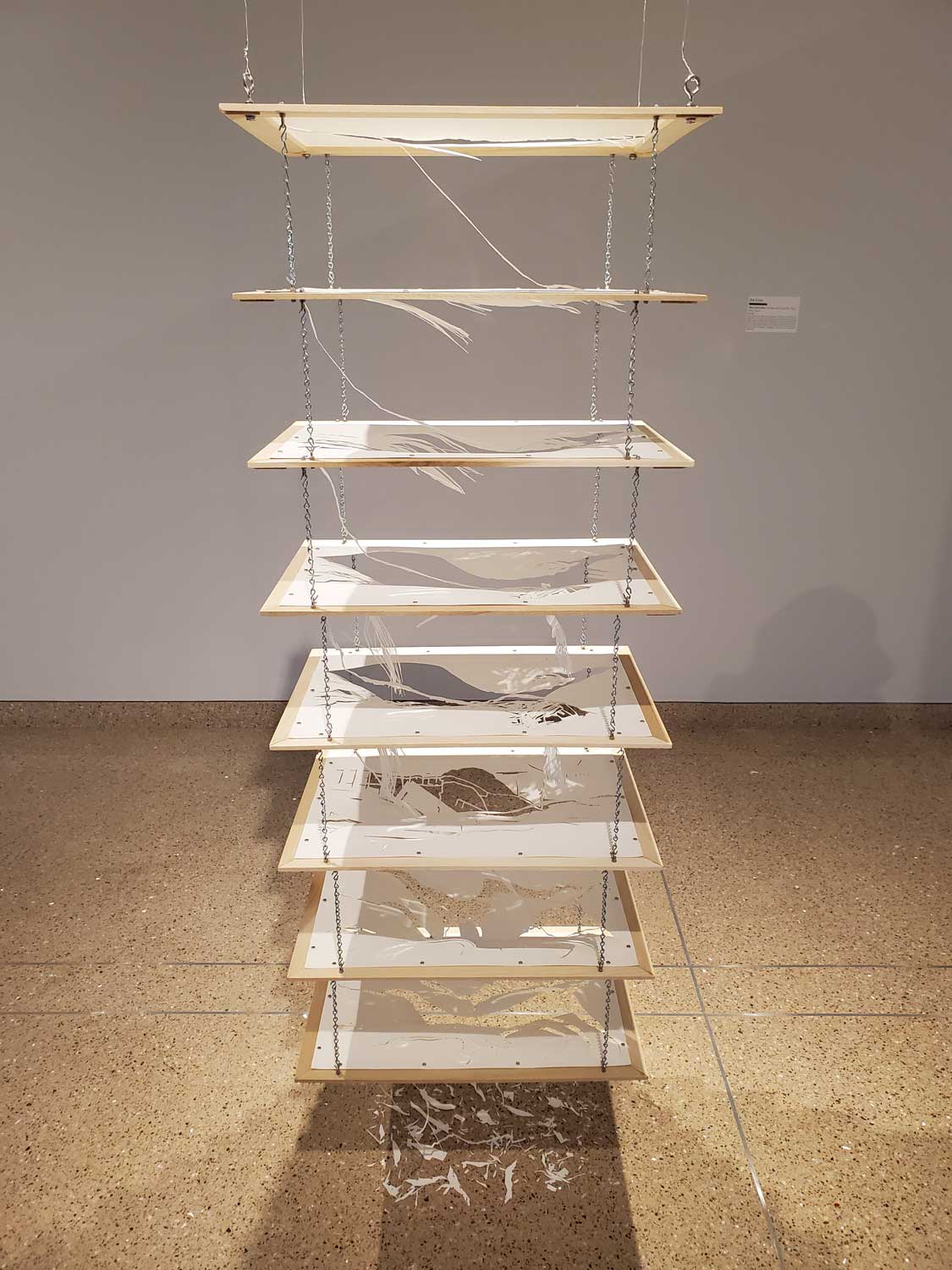
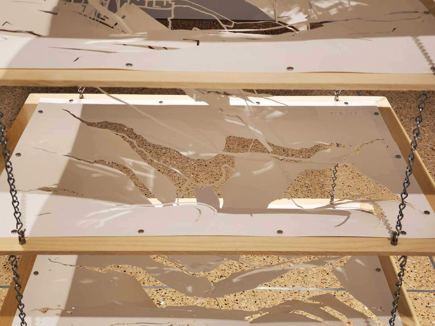
What Grows Here
2022
agave & cotton fiber paper, wood, chain: 15″w x 21″l x 60″h, tepary bean seeds, paper envelopes,
inkjet printed labels: packets: 2″x3″ shelf: 2″d 3″h x 24″w
“1,500 Years of Water Use in Phoenix” inkjet print on agave & cotton fiber paper: 13″ x 19″
Each layer of this vertical, paper map cuts out areas of water use in Phoenix, AZ beginning with ancient canals dug by the Ancestral Sonoran Desert People, 450 AD to 1450 AD, then through modern times in 1911, 1970 (pre-Central Arizona Project) and 2022 (post-Central Arizona Project). This hanging, vertical map was displayed with a limited-edition print of all 7 layers combined together, printed on agave and cotton fiber paper. Available for sale on steadyhandmaps.com. Additionally, visitors were welcome to take packets of tepary beans, a nutritious, arid crop that requires little water and has been grown in the Southwest for millennia.
Sources: Pueblo Grande Museum, Arizona Memory Project, Maricopa County Historical Aerial Photography, Archaeology Southwest online presentations, Google Maps