Phoenix Cactus Map
2020
original: ink on paper, 1st & 2nd edition digitally printed on 100% PCW recycled paper, 22″ x 28″
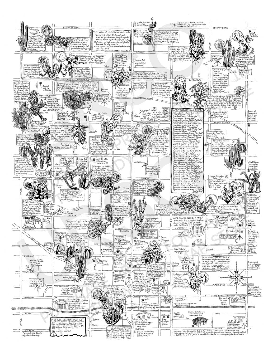
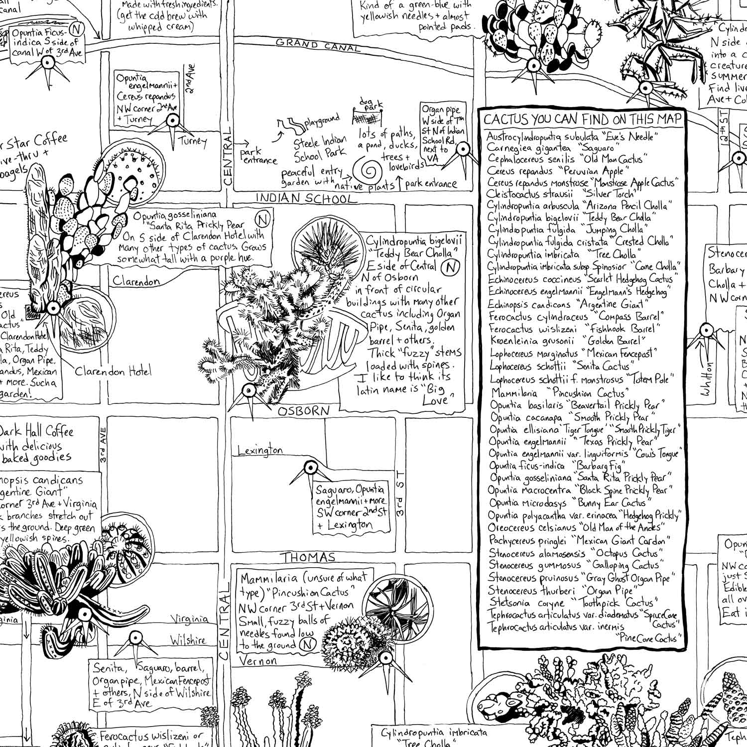
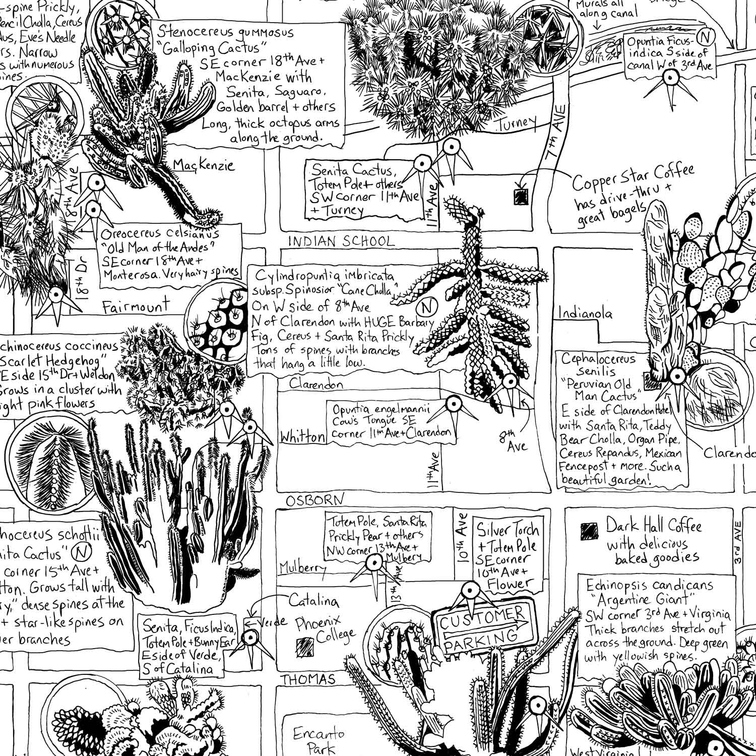
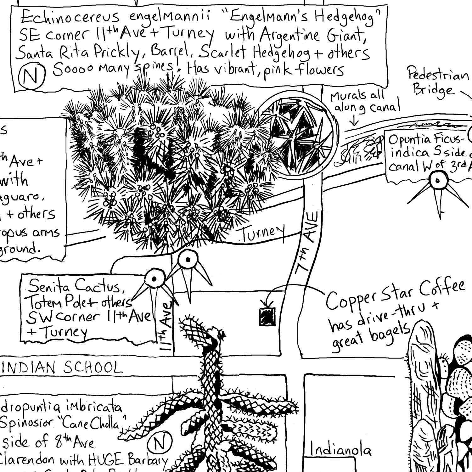
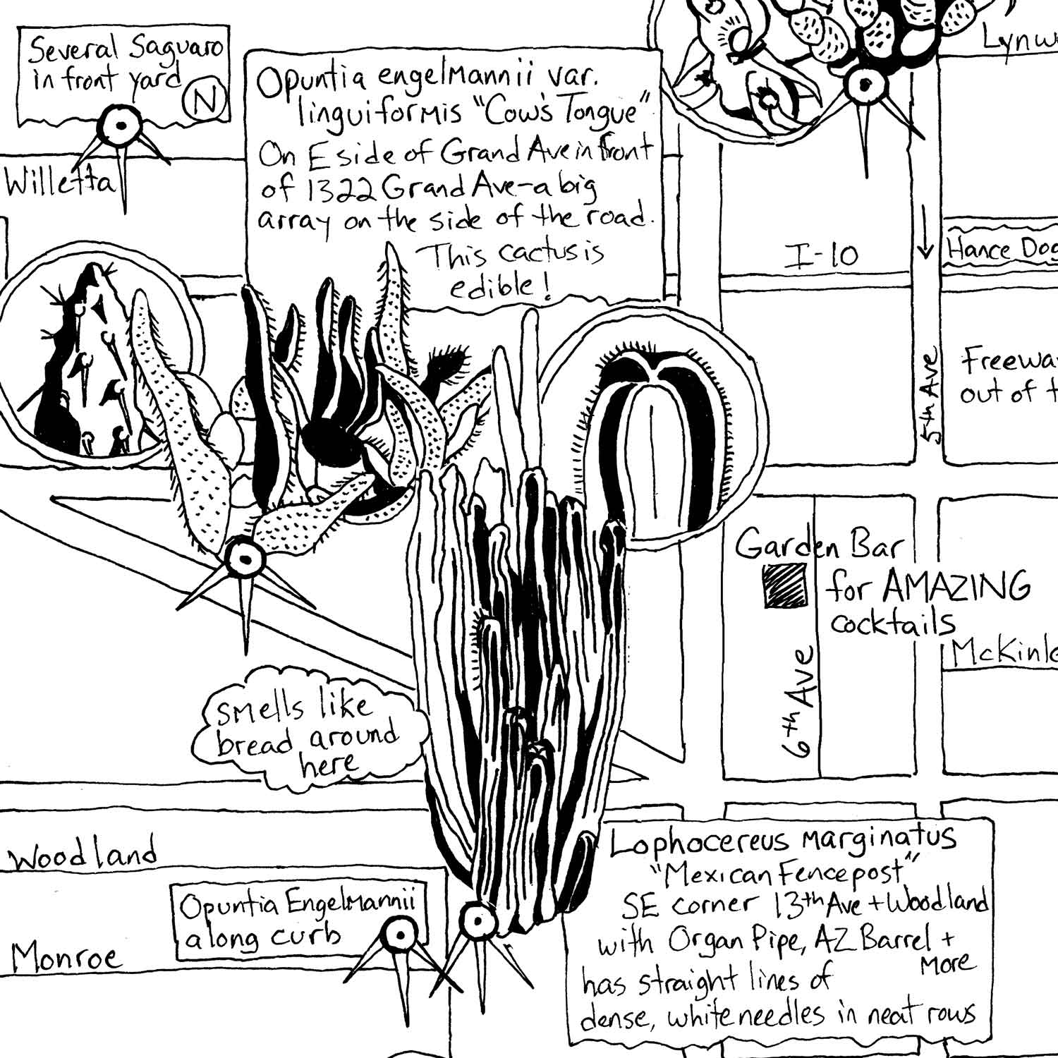
Most maps tend to focus on the built environment. The Phoenix Cactus Map focuses on the diversity of the urban Sonoran Desert in Central Phoenix. Over a year’s time, I tracked, plotted, photographed and drew all of my favorite spots to see cacti in the Central Phoenix region.
Years of being hired to create urban maps that often focused on buildings and businesses emphasized how the city is constantly in flux. As soon as a map is created, it is already outdated. Businesses that seem like they would last forever go bankrupt or move locations, transportation alters vital corridors, fire and floods can wipe out a building altogether. I was frequently hired to update the current state of the area. It seemed a shame for the focus to always be on rectilinear buildings when some trees and cacti outlived them by hundreds of years. Don’t we know our city just as much from the large tree canopy that provides us shade as we do our favorite coffee shop?
In 2019, I began traversing the city on foot, bike and car to scout the most interesting cactus planted intentionally and that happened “accidentally” (like on the side of the canal). I uncovered over 30 types of different cacti (2nd edition updated to over 50), as well as information on all types of cacti found at each location. This map was created as an intentional learning tool for all desert-dwellers or anyone who simply loves the botanical world.
Although not all varieties included are native to Arizona, they all thrive in our alkaline soil and drought conditions. This hand-illustrated cactus map encompasses all of Central Phoenix. That includes Buckeye Road in the South to Bethany Home Road to the north and 19th Avenue to the west and 16th Street to the east.
Prints are available for sale on Steady Hand Maps.
View the PlantPop film about this map on PlantPop.com